North Carolina’s Mountains to Sea Trail
The most celebrated long distance hiking trail in the United State – and perhaps the most celebrated in the world among trails of its length – is the Appalachian Trail. This 2000+ mile footpath traces most of the Appalachian range from Georgia to Maine, and is what gave the term “Thru Hiking” its name. The lore of this trail alone has contributed greatly to the popularity of hiking that exists today in this country.

North Carolina is fortunate to have some 321 miles of the Appalachian Trail either inside the state itself or directly along the shared border with the State of Tennessee. Not to mention many more miles of trail that are within a few hours drive in the states of George and Virginia. (The AT’s closest approach to our house is probably the section where it joins the Blue Ridge near Roanoke, VA.)
However the AT is not by any means the longest hiking trail in the state of North Carolina. That honor clearly belongs to the Mountain to Sea Trail, which sinews its entire 1175 mile length across the state of North Carolina, one side to the other.
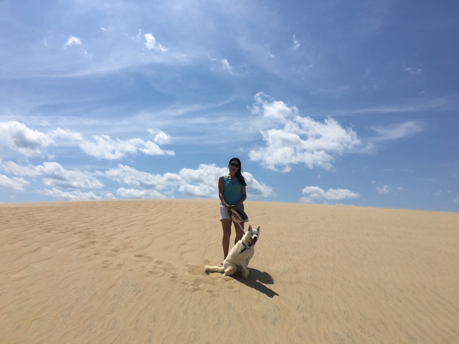
As the name implies, the Mountains to Sea Trail begin in the Mountains – at Clingman’s Dome, on the TN/NC border in Smoky Mountains National Park – and then gradually slides seaward, ending finally in the dunes of Jockey’s Ridge State Park.
We just recently visited Jockey’s Ridge.
Very few are aware that the MST is more than half as long at the AT. The Friends of the Mountains To Sea Trail recommends allotting some three to four months to hike the trail in its entirety.

- It seems that everywhere we go, there’s the MST!
The MST is by far the closest actual long distance trail to Brian and Sylvia, being only a 15 minute walk from out home (the AT is three hours away at closest approach.) We routinely bike, walk, hike or run the paved and unpaved portions of it near our house.

The Falls Lake Trail and the Neuse River Greenway are both part of the MST, as is parts of the trail system of Eno River State Park.
In addition to the aforementioned Clingman’s Dome and Jockey’s Ridge, points of interest on the trail include: Hanging Rock State Park, Pilot Mountain, Stone Mountain State Park, The Tanawha Trail, Waterrock Knob, Grandfather Mountain, The Linville Gorge, Mount Mitchell, Cape Hatteras Lighthouse and Asheville NC.
You can have both mountains and sea on this trail! Though admittedly not quite at the same time.

There are two important caveats about the MST. First, end to end it is not yet complete. In fact, only about half (some 700 miles) of the trail’s proposed route is on natural surface, IE a hiking trail. Much of the rest is road walking. Therefore, a thru-hike at present would require some serious (days at a time) walking on blacktop, especially on the eastern and central sections.
The second caveat is that only part of the MST is in the mountains, and less than that is by the sea. In fact the majority of it — the parts that traverse North Carolina’s Piedmont and Tidewater sections – are somewhere in between.
In the Carolinas, we call the in between lands the Piedmont (for the upper part of it) and the Tidewater (the lower.) What we don’t call any of it is particularly exiting. Much of it is flat, devoid of views and not far from developed areas. In fact, no small part of the Tidewater is “wetlands” (IE, mosquito infested swamps.)
Brian and Sylvia can attest that the land eastward comes in three varieties…mostly flat, completely flat and actually underwater. Therefore, a thru hike of this trail is unlikely to be quite the level of experience, either scenically or culturally, that the AT is.

However, parts of it – the parts away from big cities – will be much less crowded.
Because of the incomplete nature of the trail and the fact that two thirds of it is flat walking (or possibly wading) Brian and Sylvia recommend doing the MST in sections. Fortunately, most of the western sections are complete, follow existing natural surface trails and traverse through deep forests and rugged, mountainous terrain with many fine views.
The FOTMST website has a nice interactive map with very good breakdowns of each section. We’ve never done a complete section of this trail, but have hiked parts of virtually every western section. We would recommend any of the sections one thru five on the map; everything between Clingman’s Dome and Stone Mountain State Park. This entire section is continually mountainous and has only one road walk, that being seven miles along the Blue Ridge Parkway in the first section. We would also recommend section seven, which passes through the Sauratown Mountains, from Pilot Mountain to Hanging Rock.
Those who don’t enjoy slogging through the flatlands might also want to check out the paddling alternative via the Neuse River, NC’s longest river entirely within the state borders. This section (sections 11a to 16a) starts at Smithfield and ends at the river’s mouth in Havelock, just east of New Bern on Pamlico sound. We have kayaked on the Neuse before, though never that far east.
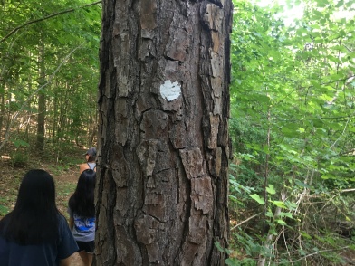
Sylvia and Brian bump into sections of the MST virtually every time we go exploring, so much so that it seems almost ubiquitous. Very often we’ve pulled to the side of some road somewhere and walked down some trail only to find to our surprise the distinctive White Dot of the MST.

Note that for coastal hikers, the final segment — Section 18 — goes almost the entire length of Cape Hatteras from Ocracoke Island to Nags Head, with only some relatively short sections of causeway and some trips by ferry to break it up. The rest of it is almost entirely beach walking.
Much of the mountainous segment follows the Blue Ridge Parkway, meaning that escape out to a well traveled road is quite possible. But it also means that crowds and noise from car engines will be near at hand much of the way.
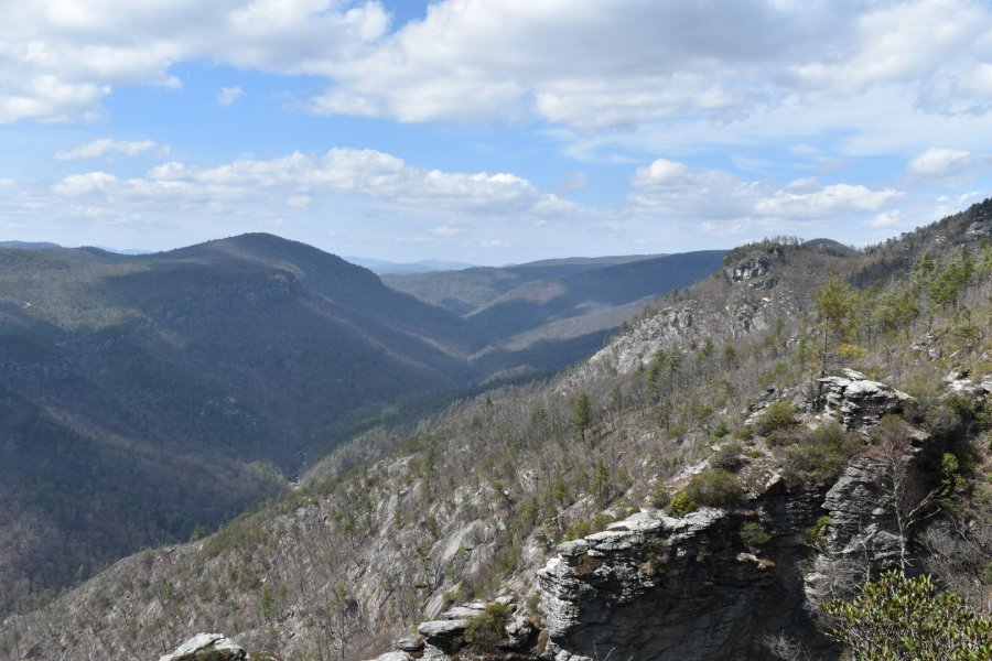
There are two long sections that pass through very remote areas where the hiker may be entirely isolated for days. These are sections four where it leaves the BRP near Mount Mitchell State Park, not rejoining it until after ti crosses the Linville Gorge; and Section one between Clingman’s Dome and the Parkway near Cherokee, NC. Hikers should prepare accordingly for these stretches and be ready for long periods without resupply.
Speaking of re-supply — unless one can get a ride from the parkway (Or Highway 12 on the coastal sections) there will be few opportunities for it on the western sections of the MST. The only close approaches to towns are when the trail passes close to Cherokee, NC during section 1, skirts Asheville along section 3 and passes almost right through Blowing Rock on section 5. Resupply can also be had directly on the trail at the Pisgah Inn. Note that this Inn and the parkway itself are prone to seasonal closures.

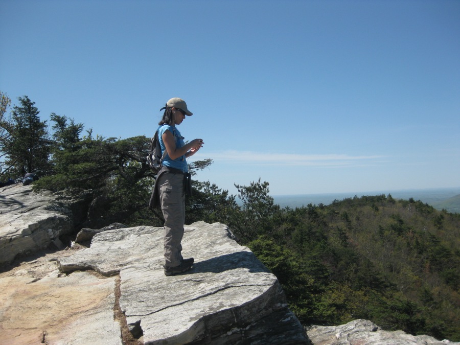
We would definitely advise caution on the sections that traverse the Linville Gorge, as this is a very wild and rugged area, and the Linville River at the base of the gorge (at last check) must be forded or rock hopped.
Those who attempt any section of the MST would be advised to do so in Fall or Spring, when the views are a little more open and the heat and bugs are less oppressive. We would definitely NOT recommend walking along miles of exposed beach in summer; this is a 62 mile slog on sand, and finding water along the way might be problematic. Amenities are further and fewer between than you might expect on Cape Hatteras, so plan well before you hike. One might even try to go in winter, if you can find any re-supply points open. If you do brave it in winter, remember the ceaseless onshore wind that makes the Outer Banks famous.
We’d love to do a section of the MST someday. Brian has his eyes on section 4 or 5.
Check out the Mountains To Sea Trail today. If you travel in the mountains of North Carolina, you are almost certain to cross paths with it eventually.
