South Mountain State Park, NC
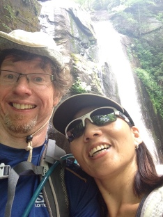
*We traveled to South Mountains State Park in the Spring of 2015. This was a sad time for Sylvia and I as my mother had just recently passed away after a long and difficult battle with heart and lung problems. Among many other things, the outdoors is a place we go to heal.
**We have added South Mountain State Park to our list of the best places to hike in the Carolinas. Though the park’s potential is mostly untapped, it could one day be a premier hiking venue!

Located at the edges of what might properly be termed the Carolina Piedmont, not far from where it morphs into the foothills of the Appalachian Range, are the rugged, sprawling and mostly wild South Mountains. Here one will find South Mountains State Park, one of North Carolina’s largest state parks. It’s about an hour’s drive from Charlotte and about the same distance from Asheville, NC. But it FEELS like it’s way out there.
It’s not to be confused with the Civil War Battlefield of the same name located in Maryland. Nor should it be confused with the municipal park (the largest in the nation) in Phoenix, AZ. South Mountain State Park IS one of NC’s largest plots of state owned public land, being just over 18,000 acres in size, which is further surrounded by state game and forest lands amounting to more than double the acreage. It boasts 40 miles of trails for hikers, mountain bikers and even horseback riders.
Being not as close to a major city as Crowders Mountain or Hanging Rock State Parks, it is not QUITE as crowded. But it can still get crowded, especially on summer, spring break and peak fall color weekends. The parks main attractions are its waterfalls, and waterfalls tend to bring in the crowds, and often the least engaged and most types of would-be hikers.
Brian, if you have not figured this out by now, dislikes crowds. ☹ He likes solitude. 🙂
There is a LOT to see in this big and rugged park and we did not by any means see it all. But here’s some of the things we DID see during this exploratory trip…
High Shoals Falls Loop
The most popular attracting of South Mountain State Park is High Shoals Falls. Only a mile from the parking lot, most visitors stop here, and in fact many never venture anywhere else (except maybe the bathroom.)
The loop trail is a 2.7 mile meander that wanders past the falls, crosses above them, then leads across a modest ridge (there are no views here) and back down to return to the cutoff for the falls and finally back to the visitor center. To the falls the grade is easy, though there are some potentially slippery rocks. Past the falls the trail is steeper, and there are a bunch of wooden steps.
The trail runs alongside the Jacob Fork River for a while, passing the trail you come back on if you do the loop, and then on down the brook that goes over the falls. The half mile or so to the falls is the best sections, as there are several pleasant cascades before the falls. Once you near the falls the trail proceeds along wooded boardwalks to avoid the mud and slippery rocks. There are some stairs here but nothing intense. I am of the opinion that wooden walkways in damp areas can sometimes be more slippery than mossy rocks, so beware.

The falls themselves are certainly very nice. The drop is 80 feet in total though it is not a straight plunge.
There are several viewing platforms for taking them in. If you manage to go off peak, you may even have these spots to yourself. On summer weekends, you will have to fight for a spot among the selfie-takers.

After the falls the trail climbs along some eroded sections before reaching a ridge line. There’s some backcountry campsites that way but really, nothing more to see. Many of the trails are actually bridal paths and thus have a road-like feel. On the other hand, there’s not too much traffic along this section. If you chose not to hike this section, you won’t miss much.
Chestnut Knob Overlook
Fewer people visit Chestnut Knob Overlook. Odd, because it may be the best viewpoint in the park, at least the best that is easily reachable by trail. In fact, when we hiked it, there was no one there but us.

It’s 2.1 miles one way and somewhat steep, at least along some sections. The trail diverges from the main trail behind the visitor center and heads somewhat steeply uphill along switchbacks, the first half mile or so being the toughest of it. Footing however is good and anyway, it’s not an Appalachian caliber uphill. At about a mile in, there is a marked junction…here a path leads off to the right, where a cleared patch affords one a glimpse of the falls down in the narrow valley below.

This view was only partially visible when we were there. (You could hear it well enough.) In summer you probably won’t see much but leaves, for it has become grown in. But in winter or early spring, this would probably be a great spot.
The trail keeps on for another mile at a more modest grade across a ridge line, soon arriving at a ridge top where it breaks left and soon brings the hiker to the Chestnut Knob overlook. The viewpoint comes up suddenly from the trees; it almost can’t be seen until you are just about on top of it.
You must scramble out on the rocks among the scrubby pine trees and bushes, but the reward is a great view. Try to do this when crowds are at a minimum because there is not much space on the rocks.
When done soaking in the views, you can either turn here for the slightly over two mile trip back to the parking log or return to the T junction and pick up the Sawtooth Trail, an equestrian path that eventually loops you back to the visitor center by way of the Little River Trail. There are no views along this section, though. Sylvia and I chose to retrace our steps.
South Mountains is an enjoyable park but we got the sense from this trip that we had not really seen all there is to see. The true potential of South Mountains seems as yet untapped, because the state simply has not gotten around to constructing access to all of its wild 18,000 acres. The oddest thing is that the West Side of the Park, which is almost completely undeveloped, also has the highest and maybe the best viewpoints. Buzzards Roost, at nearly 3000 feet, is the highest point in the park yet there is no official trail to it. Some however do reach it via bushwhack and report that the view is FAR better than that from Chestnut Knob…which again isn’t bad.
Here’s a trip report (without much photographic evidence.)
These people didn’t reach it, but they did find hunters, old ruins and some ugly clear cuts around the edges of the park.
Summitpost has another tantalizing picture and confirms that, yep, this is a bushwhack.
Apparently, there are a good dozen peaks in this range of comparable size to Buzzards Roost. I would LOVE for the state to start developing (in a reasonable and measured way) access to them. There is undoubtedly some great hiking here.
We very much enjoyed South Mountain State Park. The park has a LOT of untapped potential and years hence it could be the gem of the entire NC state park system. For all the poor press it has earned itself in recent years, the state of North Carolina has (under both Democratic and Republican leadership) embarked on an ambitious expansion of its state park system. Not only have they dramatically increased the size of South Mountains, but they have opened two REALLY fine brand new parks (Gorges and Elks Knob) in the western part of the state. We hope the state continues this investment in public lands, especially since our Federal Government seems to have developed a contempt for the very concept.
We feel that the developed eastern part of the park is somewhat lacking. While there are a lot of trails and trail miles, there are only a few views, and none that I would call truly epic. High Shoal Falls is very nice, but my opinion of waterfalls is somewhat jaded. Most waterfalls in greater Appalachia are better termed cascades, and this one is no exception. I have yet to see a waterfall that TRULY blows me away in the Eastern United States, New York State excepted. (Kings Canyon National Park has a good dozen that literally stun you. Even the Ozark Mountains of Arkansas have many more worthy ones.) Waterfalls with easy access trail tend to be magnets for crowds, and so with a few exceptions – Lambert Falls in GSMNP, for example – I am less than impressed by the waterworks and generally don’t expect to be impressed. I liked High Shoal Falls but…it’s no Niagra.
Admittedly, the falls is much better in high water, IE when it’s pouring rain. Here’s a video of said from Romanticashville.com that does show the falls at its best…with the faucet opened wide.
In our opinion, there are several state parks – Hanging Rock, Crowders Mountain, Stone Mountain – that at least for the time being are better, or at least have better accessible areas, than South Mountains. Again, in the future this could change. Intrepid souls who wish to make their own way to the tops of these peaks, without crowds at all, will find this a paradise. And maybe someday that is exactly what we will do! There’s unfinished business in the wild South Mountains.