*This post originally appeared on the blog in December 2017…We have re-posted for the enjoyment of all during our ‘Summer re-runs” while Brian and Sylvia are in search of new adventures.
*We have added the Skyline Trail on Mt. Rainier to the list of Great Hikes in the USA and Canada!
In my opinion there are seven natural wonders that every American should try to visit in his or her lifetime. They are:
- Yellowstone National Park
- The Grand Canyon
- Yosemeti National Park
- Grand Teton National Park
- Monument Valley
- Mount Rainier
- Denali National Park
With this trip, I scratched another off my List.
At 14,417 feet, Rainier is not the highest Mountains in America. But it is ONE of the highest, and thanks to its distinctive shape, conspicuous glaciation, proximity to the ocean (and city of Seattle) and lack of other prominent neighboring peaks, it is perhaps the most distinct and well-known mountain in the United States. It dominates its surroundings to a degree that no other mountain in America does.
It is also, by the way, an active volcano. But it’s been quiet for over a hundred years at least.
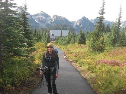
I have been wanting to come here for years, and finally, here I was. Typically, I avoid the crowded spots, but the purpose of this trip was to enjoy the scenery like a tourist, just for once. So, we booked a few nights in the park’s rustic Paradise Inn Lodge. Located at 5000 feet, in the aptly named Paradise area, it is open from April to September. In the winter, the snow pack can cover the roof.
https://www.flickr.com/photos/uw_digital_images/513806707
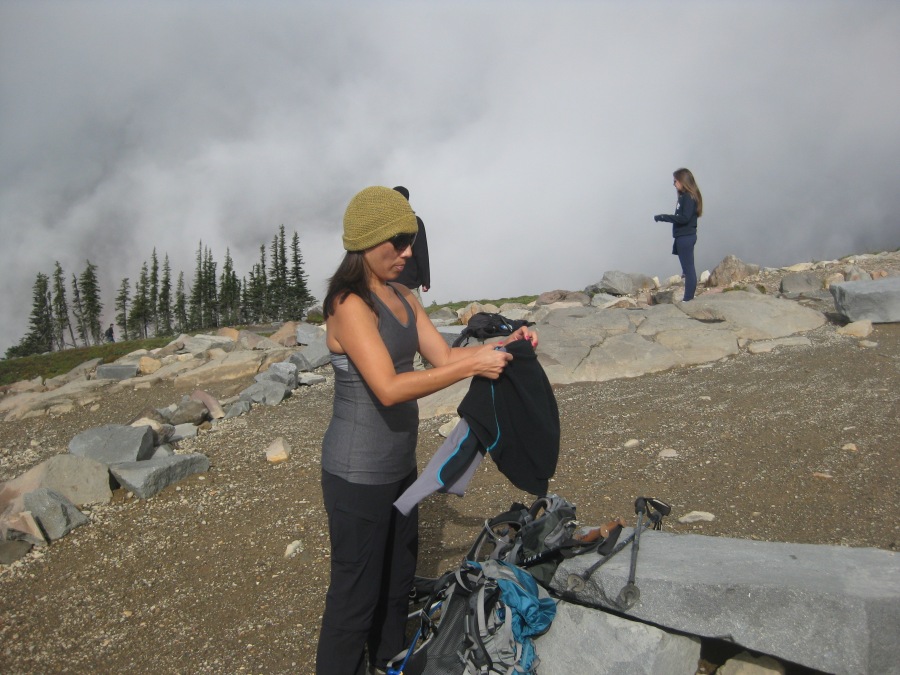
Now, if you LOVE crowds of people, Paradise Inn is a…Paradise. We were there two full days, mid-week, past peak season. And we had one day of good weather. During that day, Paradise was MOBBED. Well, it’s Paradise, right? You’d figure people would want in.
On the other hand, we had one day of HORRIBLE weather, and on that day, only the people in glacier-walking boots went out. Before you start joking about us being fair weather hikers, let it be known that bad weather in the Cascade Range means ***BAD*** weather. It takes a stout heart to venture out into those conditions on a day when you are guaranteed to see nothing but cloud.
How about them Seahawks, huh?
On the bad day we stuck mostly to touring the park roads. There just wasn’t much to see. The waterfalls were, uh, running okay. In the lodge, scores of sodden tourists huddled by the lodge’s two huge fireplaces, wringing out damp socks. Not appetizing. But the inn is a really cool old building, a classic lodge of the ‘Shining’ variety, and our room for once actually had a GREAT view of the mountain itself, the Columbia Crest looming directly above us. When you could see it, that is.
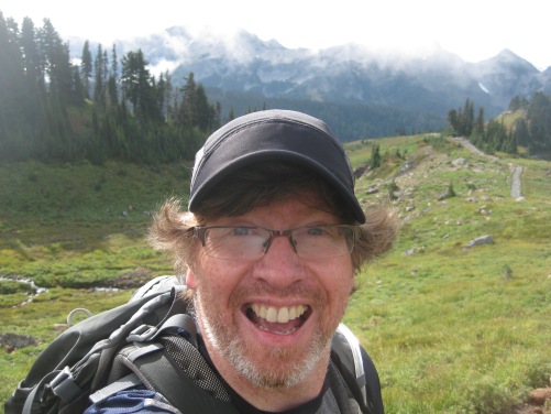
I LOVED it. My excitement was such that every time the mountain appeared from behind a cloud, Sylvia would say, “There’s your buddy again.”
With one day completely shot by bad weather we had limited time to hike. So we decided to take advantage of the great opportunities right behind the lodge’s backyard…the Skyline Trail of Paradise.
https://www.nps.gov/mora/planyourvisit/upload/Paradise-Area-Trails-Aug11.pdf
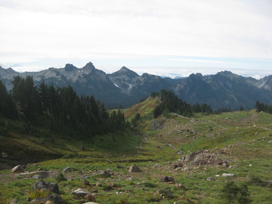
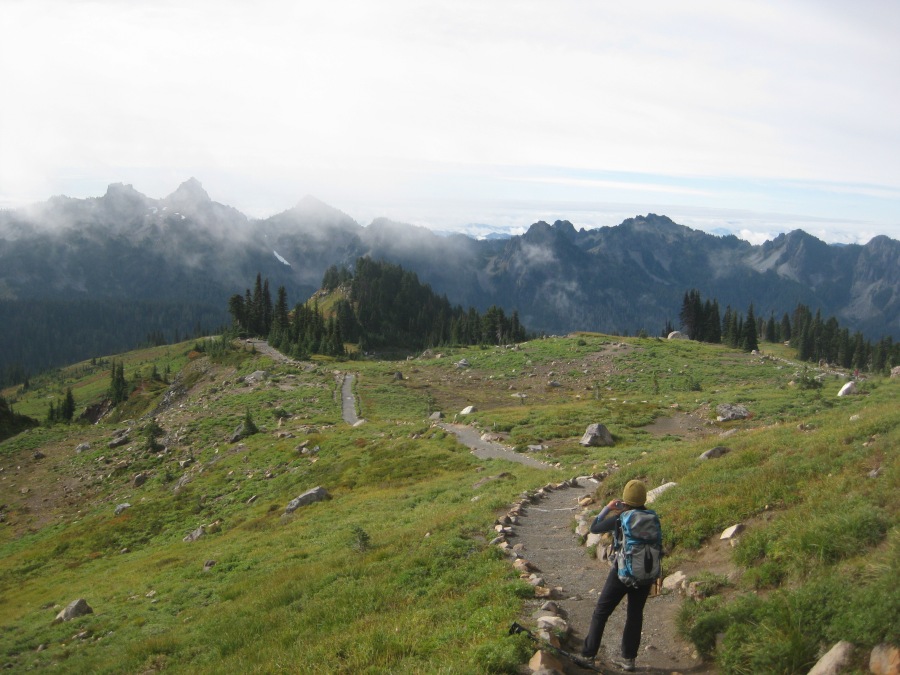
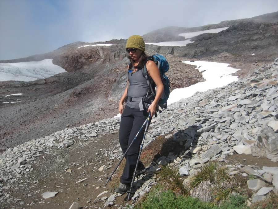
The 5.5 mile High Skyline Trail is a loop that takes hikers up beyond tree line (which basically starts behind the Inn) past the mist-shrouded Nisqually glacier, over the high ledge known as Panorama point, skirts a rocky crag and then down through gorgeous alpine meadows and back to the inn. It’s a spectacular hike when the weather holds and that day, the weather for the MOST part cooperated…particularly on the remarkable downhill sections through the finest alpine meadows I have ever personally seen.
The first let of the trip is on paved sightseeing trails. They aren’t as easy as you think, though. These pitches are STEEP.
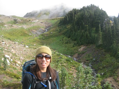
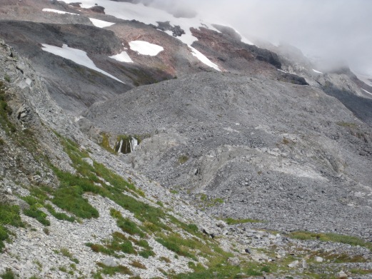
The trail eventually hits dirt and rock as it ascends past the Nisqually glacier. This part of the hike was partially obscured by fog, but there were still many fine views to the South (IE away from Rainier’s main peak.)
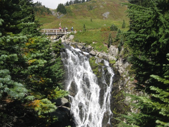
After crossing Pebble Creek and marveling at a small waterfall, we moved on to Panorama point. Here at the creek, one of the main glaciering/mountaineering routes for this side of the mountain diverges, ascending to the climbing base of Camp Muir high above.
At Panorama Point, there is a panorama and a pit toilet. But Pit Toilet Point sounds, you know, not so much.
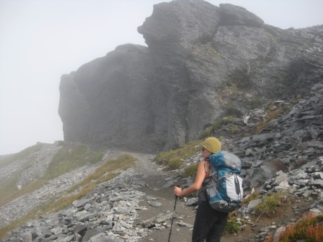
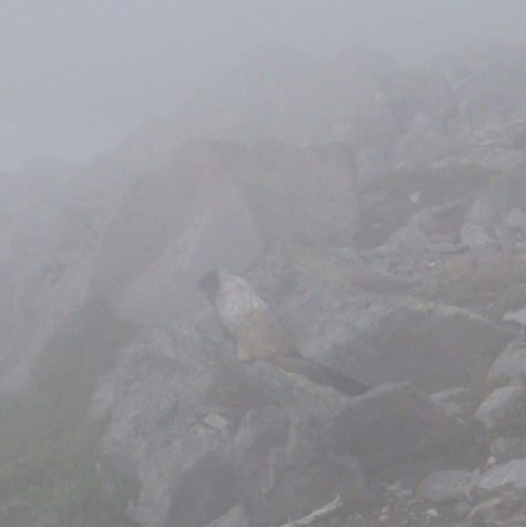
From Panorama Point the trail goes up and over a rocky crag past a flinty series of ledges. Here, there would have been some fantastic views of the mountain, but today “My Buddy” stayed well hidden behind curtain of clouds. We did however catch a few glimpses of a busy pair of marmots, frantically working to line their dens in the short weeks left before winter.
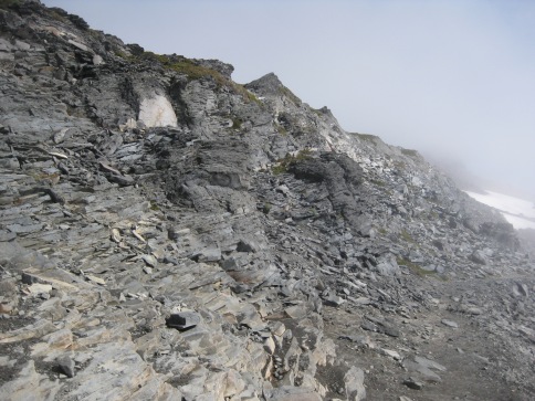
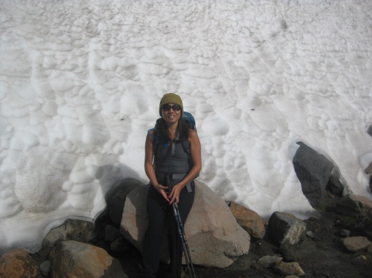
After the crag, the trail passes along one of the mountain’s more or less permanent snow fields. With 26 major glaciers and about 36 square miles of permanent snow pack, Rainier is by far the most heavily glaciated peak in the lower 48.
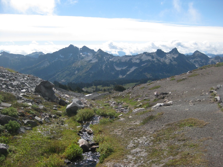
Further down we entered into a series of sprawling, absolutely gorgeous alpine meadows. Here, the obscuring mist parted to give us an expansive view.
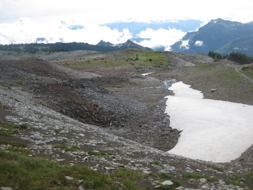
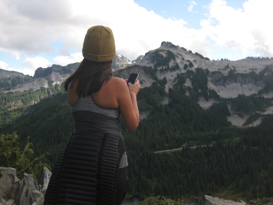
Note the saw toothed peaks in the distance, which are mere foothills of Rainier.
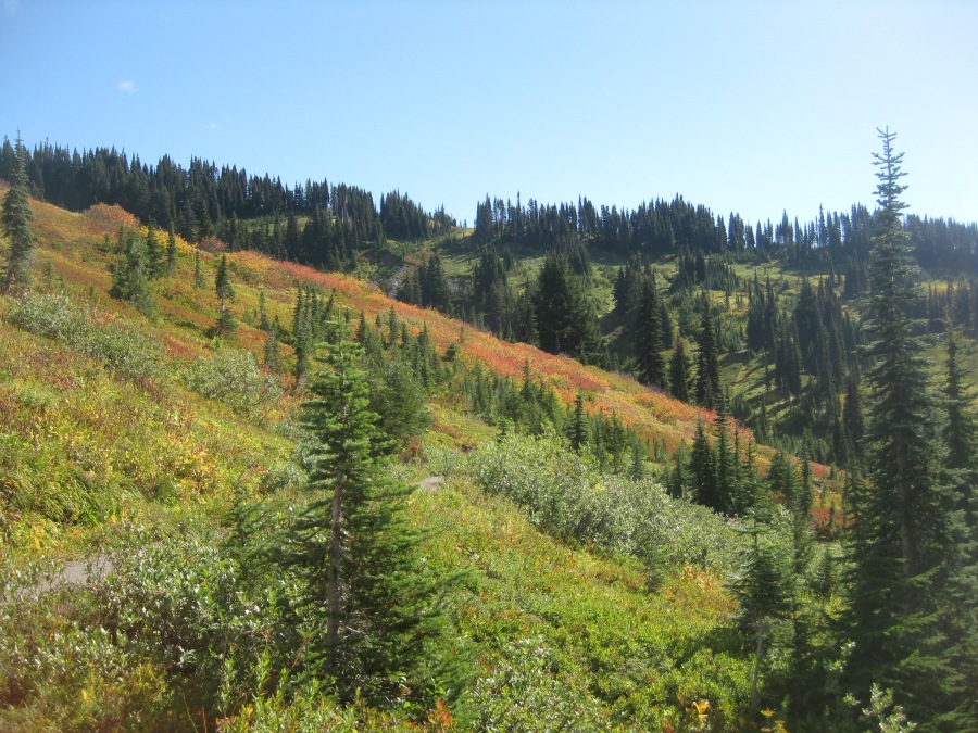
Fall colors were already beginning to show in the meadows in late September. Winter is coming.
Eventually the trail wound us back to blacktop paths and to the lodge and visitor center. The crowds here were truly huge…I had heard how much more popular Rainier had become in recent years, but still, as always, I am unprepared by the sheer pressure of humanity on our national parks.
Later, we hiked a bit of the Wonderland Trail…just to say we did.
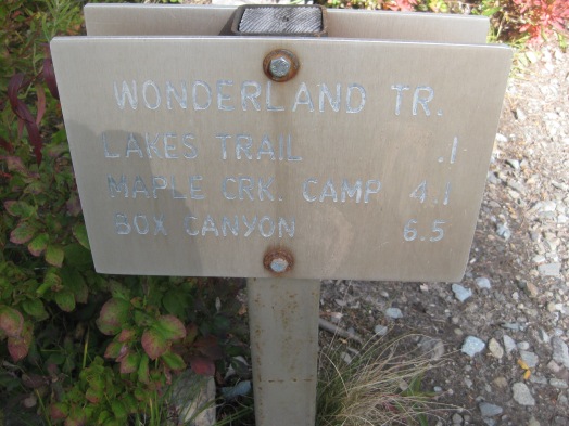
The Lakes Trail leads around the Reflection Lakes…so named because, when conditions are perfect, it’s a great place to get a photo of Rainier reflected in them. Unfortunately, this was not one of those days.
Here is probably the best picture of Rainier that I personally took all trip…there just weren’t many opportunities with the mountain playing peek-a-boo in the clouds.
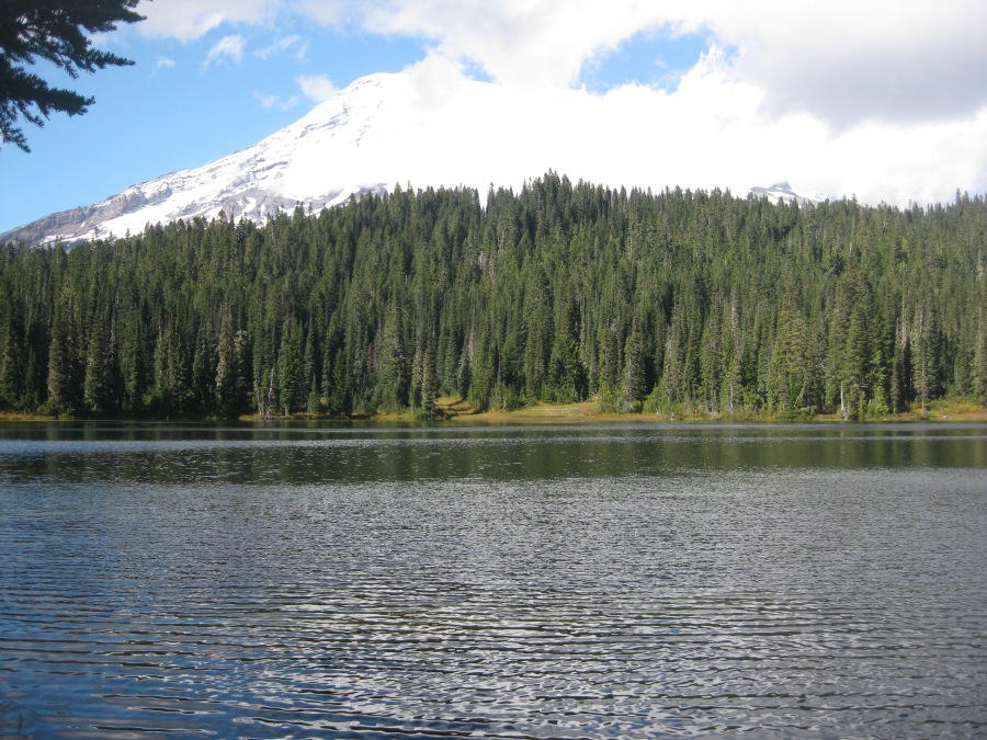
On a more favorable day for photography it looks like this…

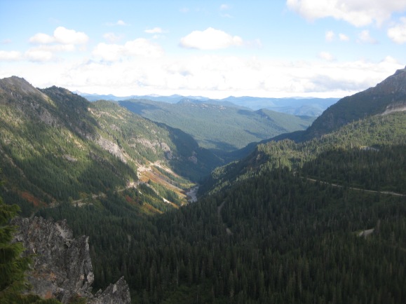
The Lakes Trail follows the Wonderland Trail for a short distance, before breaking off up the forested slopes to eventually link up with the Skyline Trail which we had hiked earlier that day. Our destination was a viewpoint to the South over the lakes and the deep ravine known as Stevens Canyon…the better views that day being to the south.
One thing I learned about the Pacific Northwest is, all the hiking here is very much weather dependent. With the exception of the Mount Constitution Hike, where we had almost startlingly clear weather, it has factored every time. You either get great views or nothing, and everything depends on getting that window of visibility.
The trail was uncrowded and rose through thick forest (the trees of the Pacific Northwest are vert tall and straight, thanks to no shortage of water.) Then we burst out on a ledge with great views of Rainier’s volcanic adjunct peaks, and the Lakes below.
After the hike we drove back to the lodge, dodging the crowds to enjoy a fine dinner at the lodge’s restaurant. And as I recall, a few more Alaska Ales.
Did you know…
The mountain we know as Rainier was named by the British explorer George Vancouver, who saw it from the ocean long before Lewis and Clark. It is named for Admiral Peter Rainier, a friend of Vancouver. Admiral Rainier almost certainly never saw the mountain named for him.
Mt. Rainier was originally called Mt. Tacoma by the Native Americans, which according to some translations means roughly, “Mother of waters.” Another possible translation however would be less elegant…“The Mountain bigger than Mount Baker.”
Though it has shown little activity for generations, Rainier is considered one of the most potentially dangerous volcanoes in the world because of its proximity to populated areas.