Time for Fall Maneuvers!!!!

October is finally upon us, our favorite time of the year for hiking! The end of summer means the end of heat, haze and humidity, the beginning of crisp, cool, clear fall days, and the arrival of fall colors.
Well, at least it usually does. For the second straight year, fall has arrived late to NC.North Carolina’s warmest year on record was 2017, and this year has been another scorcher. The historical average October high daytime temperature for Raleigh, for example, is 72 degrees. The first eleven days of the current month ALL placed well above this average by at least 7 degrees (with one full-on 90 degree day.)
2018 by the way is already the fourth hottest year on record, globally, and that was despite a cooler than average start.
Typically fall colors start in the NC/TN mountains in early October and peak in mid-October. Last year, we ventured out west three separate times, the last trip being mid-October. We hardly saw ANY color at all. ☹
The colors finally did arrive at the end of the month…almost the same time they typically peak here in the Triangle region.

-

This is Waterrock Knob photographed on October 14 of last year. Colors should be right in Peak at this time, or maybe even a bit past. As you can see, mostly still green.
Warm it may be, but it’s still cooler in the mountains. We set out for the high ground, frankly not expecting to see very much in terms of leaf change action. With a long (4-day) weekend to spend we decided to go up and down the length of the North Carolina Mountains searching for Fall. If we didn’t find colors, heck, we’d find something.
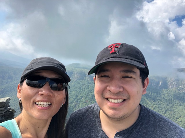
For this trip we decided to bring along young nephew Mikey who is ‘not from around these here parts’…he is from Texas. Though he had visited us here in NC before, Michael has never really seen the NC mountains. The highest peak in Dallas is, of course, the top of whatever it is the Cowboys currently use as a practice facility. Mikey has declared the southern Appalachians “The dang ole durndest thing he ever did rightly see.”

Our first stop was Hawksbill Mountain in the Linville Gorge Wilderness. After that, we had a fairly open agenda.
(This Hawksbill Mountain should NOT be confused with the mountain of the same name in Shenandoah NP in Virginia, which also has a great view. )
We had hiked Table Rock Mountain and the Chimneys in Linville Gorge earlier this year preparing for the Tour du Mont Blanc and were very eager to see Hawksbill. We already consider the Gorge to be the best place to hike in all of NC.
We did see a FEW trees changing in the Grandfather Mountain area. Not many.
Though we are leaning more toward wilderness camping these days, we decided to forgo doing it this time for Mikey’s sake. This meant jumping through some hoops to secure a campsite on a busy weekend.
With his usual firm grasp of events, the M.E.P. had ‘misplaced’ the fact that it was Columbus Day weekend, which would make it super hard to get a campsite. But we were able to finally find one along the Blue Ridge Parkway.
We were expecting some rain. Brian let Mikey borrow his old MSR Hubba solo backpacking tent, the same one that survived a six-day crossing of the Sierra Nevada several years ago. It had shipped some water then but through the bottom of the tent, not the rain fly…Brian had replaced the fly just prior to that trip, so it was still relatively new. And that had been a BIG storm.
Brian figured that he could get another year or two at least out of the tent. Wat culd possiblee go rong?
Well, after unpacking the tent, it became clear just what exactly might go wrong. Even though Brian had taken great pains to properly store the tent, the rain fly had once again started to show signs of deterioration. But still, he thought it should hold out for one or two more trips, assuming it did not rain TOO hard.

The first night it began to rain a little before 11 PM and quickly escalated to full on cats and dogs downpour – raining so hard we could barely hear the sound of our own voices over the deluge. When it slackened enough to permit human speech, Michael informed us that the solo tent WAS in fact leaking.
The rain eventually tapered off to a drizzle but did not fully stop until almost morning. Michael was able to stay mostly dry somehow, though some of his things did. He reported having dreams where he ‘was floating on a raft at sea.’
Oops. Sorry, Mikey. We had a car that could have been used as a shelter, but still,,,Brian had neglected the cardinal rule of outdoor survival, which is…above all, stay dry.
Needless to say, this tent will be thrown away.
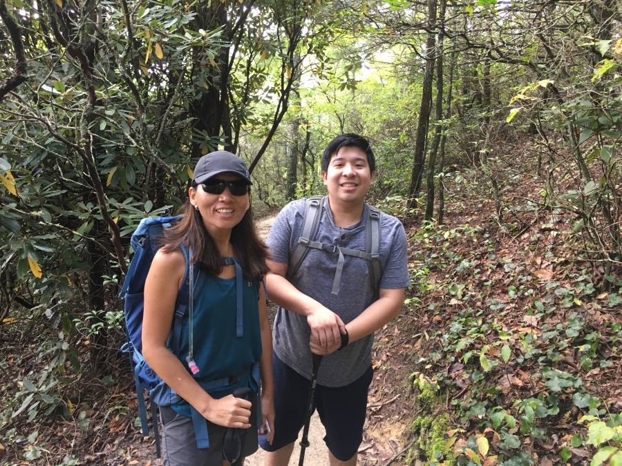
The hike to Hawksbill Mountain starts from Forest Road 1264 near Linville Falls, NC…one of several good hikes from this road. The Hawksbill Mountain trail is about 2 ½ miles down this road on the right-hand side…though the parking is mostly on the right. Bear in mind that there isn’t much parking along this narrow dirt road…it’s a popular trail and late arrivals may be forced to park well down the road at whatever spot affords itself.


The trail to the summit is fairly short, only one and half miles, and nowhere very steep, but is somewhat rough in places. The very heavy rain the night before did not make things any easier.


It passes the Jonas Ridge Trail at a junction signed only as ‘parking’. Just below the summit is an open area with several open campsites. Camping IS allowed in the area, though on certain periods you need a permit. Check the National Forest regulations.
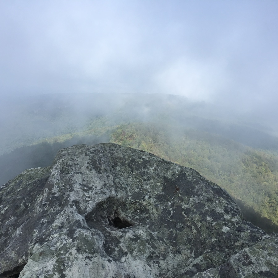
The views from this area were not promising. While the day had started sunny, a thick blanket of clouds had since moved in.

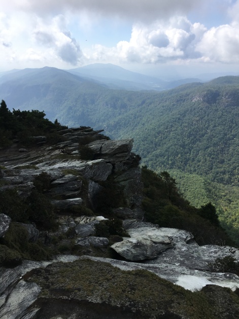
We continue to the summit, visible just a short distance away. From the clearing, the RIGHT most trail is the one to the best views. There are some steeply pitched rock slabs here, which could be quite dangerous if wet and would certainly be dangerous in icy conditions.
The summit of Hawksbill is basically an expansive rock garden with VERY impressive views. And as luck would have it, just as we arrived the clouds began to break up. At first we had difficulty orienting ourselves because all the landmarks were enshrouded…but then Table Rock Mountain shook off the clouds and reared its head from the gloom, and we knew exactly where we were in relation to everything!
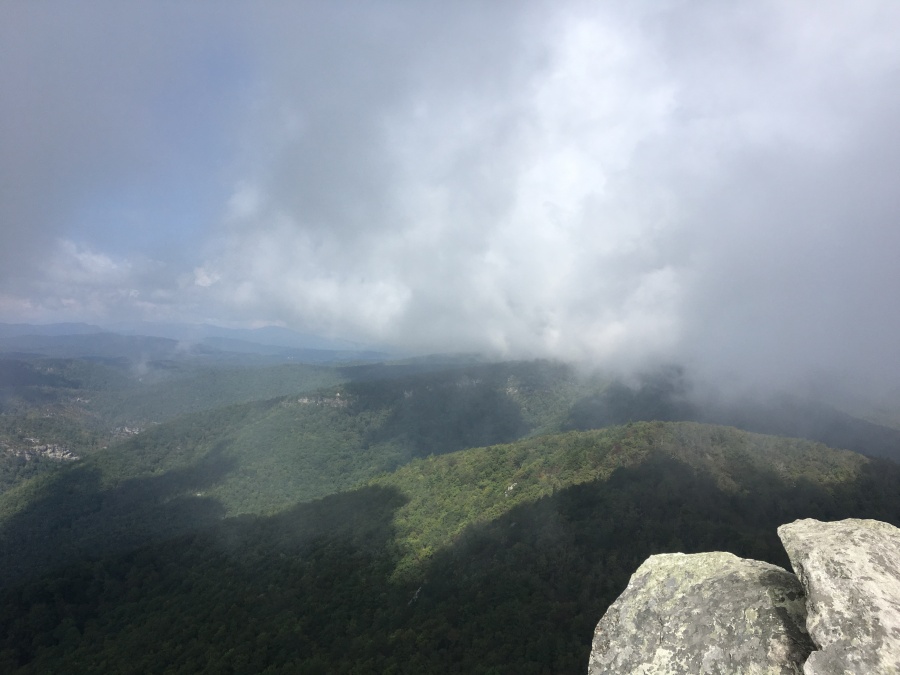


We thought the views here to be in some ways better even than those from Table Rock Mountain and the Chimneys. Though the panorama is not quite 360 degrees, Hawksbill Mountain is well positioned to give a birds eye view right down the Gorge…particularly in the Southwest direction (towards Morganton/Marion NC.) Table Mountain and Shortoff Mountain looked quite impressive, wreathed in clouds.
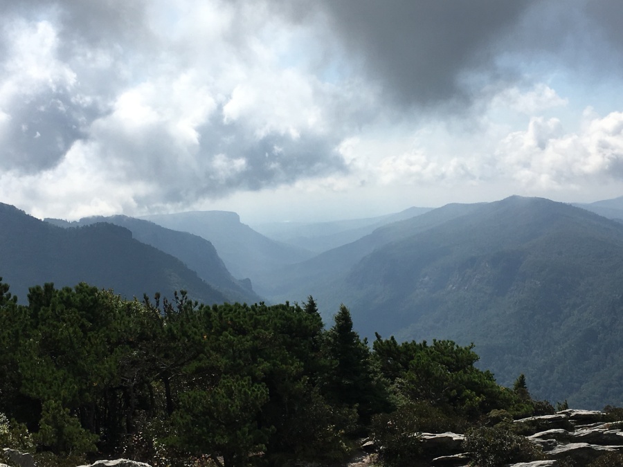

The views into the Gorge from here are equally impressive, and again maybe even a little better than those from Table Rock Mountain. You can easily hear the roar of the river below.

Another unusual thing about this vantage is that you can see over a portion of the far rim and into the developed (mostly agricultural) areas beyond. From Table Rock, you cannot see almost ANY development at all except far away in the opposite direction (toward the Piedmont.)
On the summit we met a young man named Ian from Elizabeth City who had actually tented on the summit and had been caught, unprepared, in the heavy rainstorm of the previous night. Interestingly, he was with the Coast Guard…maybe he could have offered Mikey advice on what to do when adrift at sea on a raft, but I felt it best not to ask.

Ian was trying his best to dry out his thoroughly drenched equipment on the rocks while doing some photography. We lent him some sunscreen as he cursed himself for being unprepared. Well, he wasn’t the only one.
Oh, speaking of unprepared, it was just about when we started the hike that the M.E.P. realized that he had committed a second, and perhaps worse, cardinal error. He had forgot his and Sylvia’s rain gear at home – meaning that we were at the mercy of the elements.
Mikey, fortunately, had brought his. All WE had was a lousy umbrella. 🙁
The summit of Hawksbill Mountain is an awesome place…it’s also a big place, with plenty of room for people to roam around and find a secluded spot to gaze at the moments. We intend to be back again.
And we intend many more future expeditions around the gorge…we still have yet to do Shortoff Mountain…to say nothing of a trip INTO the Gorge itself, by all accounts a very formidable wilderness adventure.
(As an addendum to the trip, that night we moved down the pike to Davidson River Campground and by some miracle managed to secure a site. We rigged a ground cloth up as a tarp to keep Mikey dry. You’ll be reading about that in a future post…when we do Waterfall Week II!)
(And we’re still on the lookout for fall colors!)