The Rae Lakes Loop
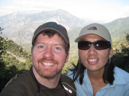
*Completed by Brian in 2014, the Rae Lakes Loop is one of BecauseItzThere’s BucketList Hikes. It is recommended to fit, self-sufficient hikers as a reasonable alternative to the John Muir Trail, which should only be attempted by VERY fit and experienced hikers.
- Location: Sierra Nevada Mountains, CA (nearest city Fresno)
- Distance: Approx. 42 miles
- Elevation Gain: Approx. 7000 feet
- Highest elevation: 11,926 feet (3635 m)
- Time: 4-6 days
- Difficulty: Moderately Strenuous
- Best season: Late summer or early fall
- B.I.T. Rating ****1/2
Directions: From Grant Grove Visitor Center in Kings Canyon National Park, head east on Highway 180 until you reach Road’s End (shown on some maps as Kanawyers.) Literally, drive until you run out of blacktop. Trailhead is near the backcountry ranger station.
Brief Description: Superior loop hike that serves as a ‘greatest hits’ of the Sierra Nevada high country; includes a section of the John Muir Trail. More alpine lakes than you can shake a stick at…entire section between Dollar Lake and Charlotte Lake is one nonstop parade of eye-popping views. This hike is FAR easier to do than the very challenging John Muir Trail, but that also makes it very popular.
Why do it?
- Any hiker who can’t get excited about John Muir’s celebrated range of light should be institutionalized
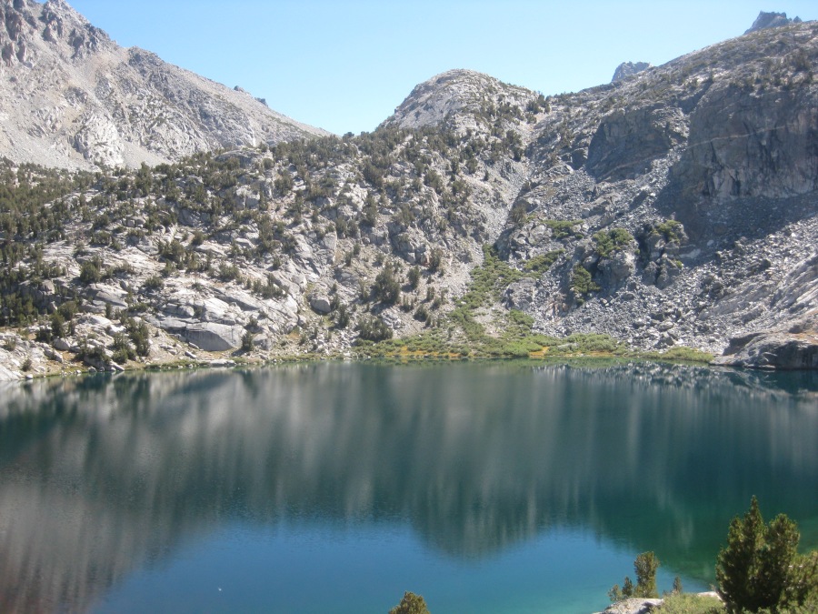
- The amazing Rae Lakes Basin, an Ansel Adams print come to life
- Towering views from knife’s edge Glen Pass
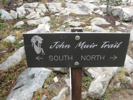
- Best section follows the John Muir Trail
- Functions as a sort of highlight reel of the best of the JMT but with MUCH less difficult logistics
- Footing is generally good throughout; grades are mostly moderate, the pass excepted.
- Mist Falls and Paradise Valley
- The astounding King River
- Amazing cataracts on Bubbs Creek
- Lakeside camping in the high country; many fabulous sites to choose from
- Great back country campsites in general
- Potential of detour to the seldom visited Sixty Lakes Basin, which many consider even more scenic
- Other alternate itineraries to seemingly limitless numbers of high lakes
- No need for a shuttle; arrive back to where you started
- Logistics in KCNP are generally easier than crowded Yosemeti
- Unusually mild weather for a major mountain range (in hiking season)
- Good chance you will do this and see not a drop of rain
- Water available throughout the hike
- Most of the worst stream crossings now bridged, washouts excepted
- Almost continually uphill until the pass and downhill after, a refreshing break from ‘up and down’ hiking
- Drive down into Kings Canyon is almost worth the trip in itself
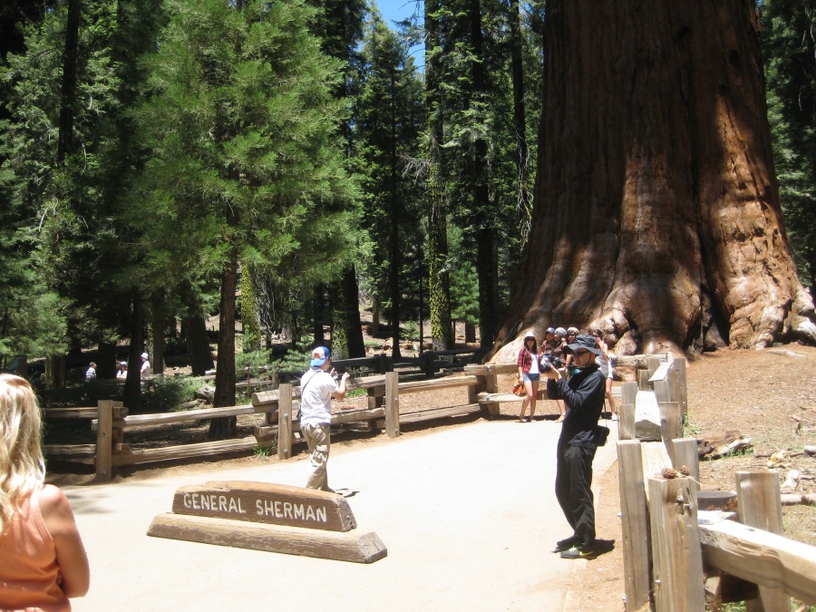
- Can be combined with a trip to Grant Grove, or even better the Giant Forest of Sequoia National Park, to see the fabulous Giant Sequoias
But consider this before you hike:
- Listed in various places as 39, 41, 42, 43 or 44 miles in length
- Whatever, it’s a LONG way
- Can be done in either direction but clockwise recommended, the ascent of Bubbs Creek Trail is long and exposed to the sun
- This can be a hot hike in summer, hydration is important
- No resupply along the way, you must take all supplies (and take out all trash)
- It’s wilderness, no bathrooms en route except what nature provides (IE the woods)
- Stashing supplies at Onion Valley possible but only with a LONG detour that includes a significant mountain crossing (Kearsarge Pass is about as big as Glen Pass)
- If things go wrong, there is virtually no evac option that does not include a very expensive helicopter ride
- Glen Pass (nearly twelve thousand feet) is a formidable obstacle
- Altitude will be a factor on the pass
- The pass is the crux of the hike; other than that, it’s generally moderate hiking
- Recommended you stay in the Cedar Grove area night before the hike; the drive in from Grant Grove, while scenic, will take nearly an hour
- A very regulated hike, getting through the red tape almost as hard as the trail
- Backcountry permits required; there is a fee in season
- Permits are on a quota system; expect them to fill up during peak summer season
- While permits can be reserved in advance, you MUST check in at the backcountry ranger station at Road’s End to pick them up
- Consider hiking in September to avoid crowds
- You must carry a bear canister, though you may not absolutely need it
- Black bears are not as much of a problem as they were a few years back, but still, they are out there
- Rattlesnakes often encountered (bites are rare)
- Clouds of biting flies in some seasons
- If you can’t carry a fully loaded pack (including supplies and bear canister) for five days across easy terrain, don’t even think about doing this
- Some stream crossings can be dangerous early in the season, or after heavy rains
- Deep snow can linger in the high passes well into July in some seasons
- In fact, because of the two points above, we do not recommend doing this trail before mid-July
- WARNING: At last check the bridge of the King River at the upper end of Paradise Valley is washed out. This is a VERY DANGEROUS crossing, with several reported fatalities
- High water may force you to turn back; be prepared for this
- Despite the typically mild weather of the Sierras in summer, this is STILL a wild mountain range – be prepared for violent storms
- Don’t attempt Glen Pass in bad weather; it’s an extremely exposed place
- Short hiking season (June to September, with June being sketchy)
- There are no quotas or fees from October to May, but conditions make hiking during these months all but impossible for anything less than a well-trained outdoor expert
- If you do any part this trail in winter you had better know what you are doing; snow depth can be measured in yards
- To attempt Glen Pass off season will require ice ax, crampons, and the ability to use them
- Alas, no clear views of Mount Whitney from the main route
Rae Lakes Loop info at Kings Canyon NP website:
https://www.nps.gov/seki/planyourvisit/rae-lakes-loop.htm
Backcountry Permit info:
https://www.nps.gov/seki/planyourvisit/wilderness_permits.htm