Can I hike the Grand Canyon rim to rim too?
The short answer is…yes, this is a hike that even modestly experienced hikers can do, if they are well prepared. But do NOT underestimate the risks and challenges. This is a SERIOUS undertaking!
For as long as there have been human beings around to stand upon the edge and see it, the Canyon has been calling to people — daring them to come down inside for a look.
First were the ancestors of the Native American Tribes we know today. After them came the peoples we have names for – the Pueblo, the Navajo, the Paiute and the Hopi. Not only was the canyon a home to them, and sacred ground, but a natural fortress…a bastion of safety whose steep, rough terrain helped keep outsiders at bay.
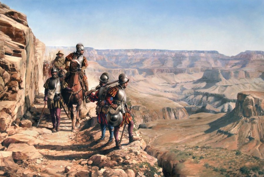
The Spanish blundered into it in 1540, barely two decades after the conquest of the Aztecs. A force under the conquistador Francisco Coronado explored the area looking for the fabled Seven Cities of Cibola. Gold was their motive, and finding none, they left the place alone. For centuries, it remained largely what it had always been.
It wasn’t until the 1870’s that the Canyon was completely explored by John Wesley Powell. It was the last remaining blank spot of the American Map. With its filling in, the era of the American Frontier West effectively came to its close.
In the last century the canyon’s disconnect from the rest of the world was ended. Almost from the beginning of the 1900’s, there has been a non-stop series of battles fought to preserve the landscape from the inevitable forces of exploitation…Those who wish to extract one form of wealth or another from it. By mining it, by damming its rivers, and perhaps most seriously of all, by charging admission to those who wish to love it to death.
Traditional Native American dancing on the South Rim
The battle continues this day between the forces trying to preserve the canyon for its own sake, and those who wish to exploit it. Most likely, this battle will never end. One thing that seems certain…the canyon itself will long survive the peoples who struggle back and forth over its bonanza of riches.
Our advice to those who wish to come and hike this Grandest of Holes in the Ground is…come prepared and leave it as you found it. Leave this great place intact for future generations to enjoy. Respect…and prepare to be blown away.
The Grand Canyon North-South Traverse
- Grand Canyon NP, AZ
- Via North Kaibab/Bright Angel Trails
- Distance: 23.5 Miles
- Time: 2-4 Days
- Elevation Gain/Loss: 10,000+ feet
- Strenuous (Due to overall length, sheer amount of climbing and desert conditions)
- Best Season: Fall or Spring
- BIT Rating: ****1/2
Directions: Trail head located 1.5 miles from Grand Canyon Lodge on highway 67 in Grand Canyon National Park’s North Rim District. Consult the NPS site for details…closet major city is Las Vegas. To the South Rim and Grand Canyon Village, closet city would be Flagstaff, AZ, but most would chose to fly into Phoenix’s Sky Harbor due to the greater number of cheap flights, then drive 3 1/2 hours North. The North Rim facilities are closed and the roads sometimes impassible in winter.
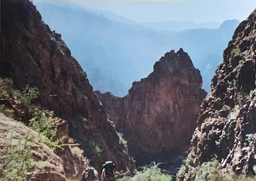
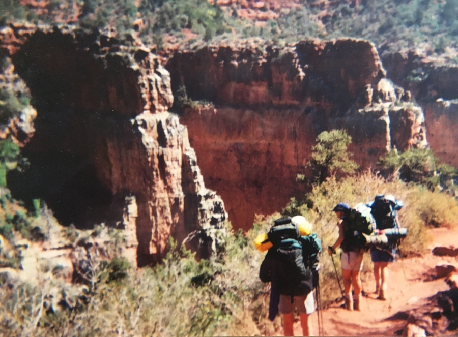
Brief Description: Crossing the Grand Canyon from Rim to Rim…If you are a hiker and THIS does not get your attention, honestly, I don’t know what to do for you. In Brian’s opinion the traverse is not a particularly difficult hike — most able bodied people could do it if they prepare. But it is a hike that could get you in serious trouble, and maybe killed, if you don’t prepare.
Why Do This?
- Recommended to any reasonably fit hiker
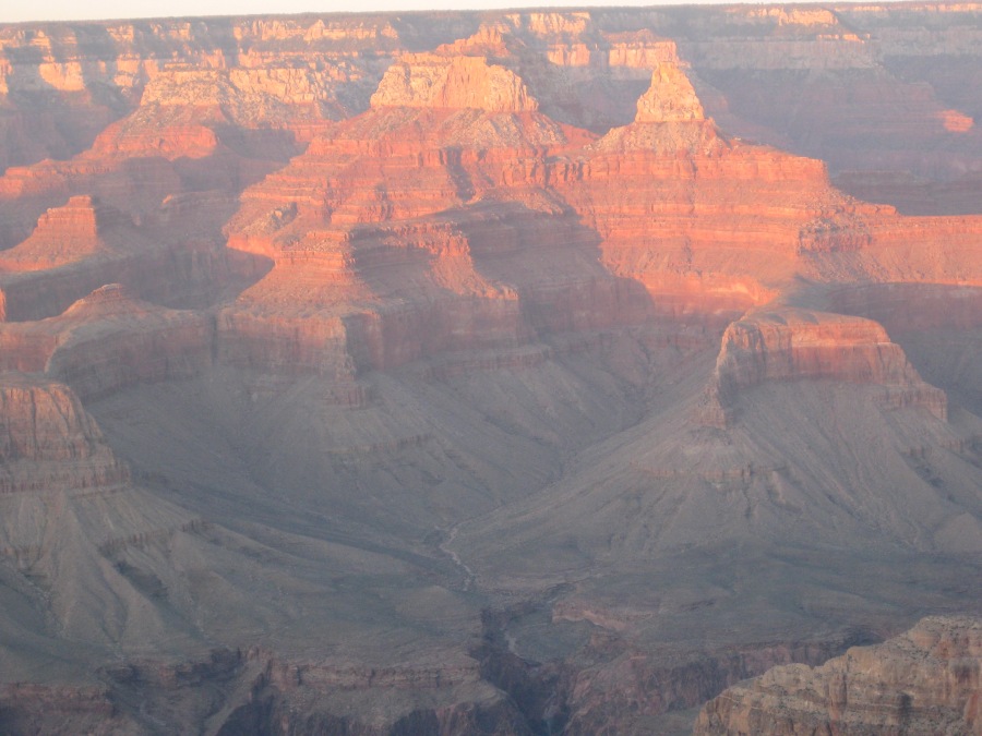
- Hike down into and out of the most celebrated hole on Earth!
- There are deeper canyons, but the Grand Canyon is the world’s most spectacular
- North-South direction recommended due to much higher elevation of the North Rim (8000 feet)
- Most popular route uses the North Kaibab/Bright Angel Trails
- Many other route options available; all are more challenging
- Elevation generally not a factor if you go south
- Trail itself straightforward, no unusually steep or rough sections
- Except near the South Rim, trail is often devoid of people
- A more scenic route (but much more exposed and difficult) is via the South Kaibab Trail
- Best done in Spring or Fall
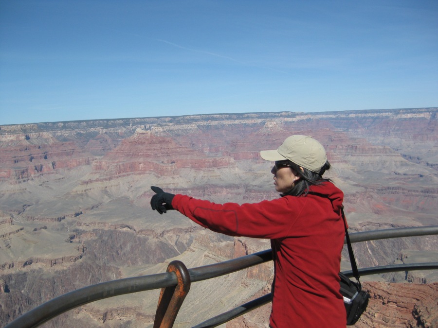
- Great views throughout
- See parts of the canyon the majority of its six million visitors never will
- Weird and majestic canyon interior
- Geology buff? Welcome to paradise!
- Stunning nighttime skies
- You can generally get away with very minimal gear here
- Cross the mighty Colorado on foot!
- Surprising number of waterfalls, grottos and springs
- Excellent campgrounds at Cottonwood, Indian Gardens
- Historic Phantom Ranch
- Real chance of seeing condors, other wildlife
- Water available at intervals en-route
- North Kaibab and Bright Angel trails have long shaded sections
- Hop on a mule if you don’t want to walk
- Ultra-marathoners do this in a single brutal day (NOT recommended)
- Shuttle services are available to take you back to the North Rim (for a substantial fee)
But consider this before you hike…
- NOT recommended in summer
- Heat WILL be a factor, especially nearer the canyon floor
- Dehydration is also a serious problem
- Pacing yourself and water management are key here
- An early “Alpine” start on the ascent strongly recommended
- Hundreds of rescues from the Canyon each year; most involve unprepared hikers
- Evacuation problematic and usually involves an expensive helicopter ride
- The worst comes at the end when you must climb out after 2-3 hard days on the trail
- Steepest sections are near the top
- Switchbacks. Lots and lots of switchbacks
- Water stations are sometimes closed, or out of service
- Hot, dusty, exposed sections of trail
- Mules, and their manure, especially on Bright Angel Trail
- Could be done in winter, but conditions at the North Rim will make this a challenge
- Almost all facilities close seasonally, especially at North Rim
- In winter expect deep snow near the Rims, especially the North
- Crowds, traffic in Grand Canyon Village must be seen to be believed
- Bright Angel Trail from South Rim to Indian Garden can be quite busy
- Be warned: challenges MUCH greater on the more scenic South Kaibab Trail
- Rattlesnakes sometimes encountered (Brian saw one)
- Wildfires can close whole parts of the Rim
- Summer thunderstorms bring lightning, trail washouts
- You will be just ten crow miles from your car when you emerge from the canyon. Unfortunately, that equals 220 road miles. ?
Useful Links:
https://www.nps.gov/grca/planyourvisit/hike-tips.htm
https://www.nps.gov/grca/planyourvisit/trail-distances.htm
Details on the rim to rim shuttle:
https://www.trans-canyonshuttle.com/
Phantom Ranch:
http://www.jacoblake.com/?gclid=EAIaIQobChMIzuvojvvf4AIVmIjICh1flw2-EAAYASAAEgIFm_D_BwE
(Note BecauzeItzThere gets no compensation or revenue from commercial advertisement. Any recommendation we make is offered entirely based on our experiences, and should not be construed as an endorsement of the services offered.)