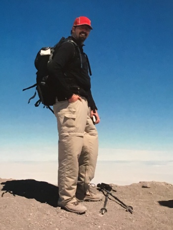
*Brian completed the Monitor Ridge Route Hike of Mount St. Helens in 2007…it was his second solo Bucketlist hike. Conditions on the mountain today may not be exactly as described here, and the permit system has changed. Check with the National Forest Service website before attempting this hike.*
**This is NOT a hike that we would recommend to novice hikers. Until 2018 when he completed the Tour du Mont Blanc, Brian considered this to be his hardest single day of hiking. Be sure you are ready for this!**
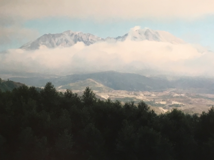
Mount St. Helens Volcano
Via Ptarmigan Trail/Monitor Ridge Route
MSH National Volcanic Monument
Distance: 10 Miles round-trip
Type: Day hike
Elevation Gain: 4500 feet
Very Strenuous (See below)
Best Season: Summer or Early Fall
BIT Rating: ****1/2
Directions: (From the Gifford Pinchot NF website): From Cougar, WA take Lewis River Road/Forest Road 90 east for 6.4 miles then go left on Forest Road 83. Follow Forest Road 83 for 3 miles then stay left onto Forest Road 81 and go about a mile to Forest Spur Road 830. Go right at Forest Road 830 and drive about .4 miles to the trailhead at Climbers Bivouac.
Note that this area is very remote and these roads may be impassable in winter.
Brief Description: Hike to the rim of an infamous volcano that erupted catastrophically within the span of a human lifetime. An almost completely unique once in a lifetime hike, but also a very challenging one.
Why do this Hike?
- One of the most memorable things you will ever do
- Ranked with Angels Landing and The Narrows as the best day hike in the US
- This will earn you some serious bragging rights
- Of all the hikes Brian has done, people seem the most curious about this one
- From timberline upward, nothing but clouds will stand in the way of the views
- Signs of the 1980 eruption are EVERYWHERE
- Hike through a variety of terrain, from temperate rain forest to jagged pumice
- Fine views of Rainier, Adams, Hood, other cascade peaks
- When the sky is clear the Cascades are incredibly scenic
- There’s something about that cobalt blue Northwestern sky…
- Stand at the exact spot where over 1000 feet of mountain was blown off
- Virtually everything you see is NEW (post-1980) as astonishing as that seems
- The panorama at the rim is impossible to describe
- Continue on to the ‘new’ summit (a high point on rim) if it pleases you
- See, feel, hear and smell the crater…it’s alive!
- Very ominous and eerie place
- Remarkable boulder fields
- Quota systems limit crowds
- Hikers generally spread out on the open sections giving it an uncrowded feel
- Finding the route in good weather shouldn’t be a problem
- Even if the hike is socked in, the rim will often be above the clouds
- Descending on the ash fields near the top is pretty easy sliding
- Some glissade down the semi-permanent snow fields
- Real chance of seeing wildlife on lower portions of trail
- Chance to see how nature is reclaiming the devastation
- Monitor Ridge is closed in winter but there is an alternative route
- If this isn’t enough for you, much harder Loowit Trail circles the mountain
- Take in Johnston Ridge Observatory, Ape Cave and other nearby attractions
But consider this before you hike…
- Mount St. Helens is dangerous
- Though not presently erupting, it is an active volcano
- A catastrophic and deadly eruption happened within a human lifetime
- Has erupted many times since 1980
- Geologists expect it will erupt again
- Volcanic events sometimes close the mountain for days, weeks
- Volcanism aside, this hike has many other potential risks
- Many injuries, deaths on this mountain, most from falls
- A man died as recently as 2018
- Lower section follows a trail, but upper sections are a route
- Route is not marked all the way to the summit
- While the way is obvious in good weather, in bad you might lose it entirely
- Visibility can drop to near zero
- One of the steepest hikes Brian has ever done
- Almost a thousand feet of elevation per mile
- Five miles will feel more like ten
- Last section over ash is one step forward, two back
- This is NOT for inexperienced hikers
- Expect bad weather
- From tree line up, VERY exposed
- You do NOT want to get stuck here in a thunderstorm
- One can get off the rim quickly, but rocky middle sections will require greater care
- Clouds can sock the mountain in completely
- The lower slopes are in fact seldom cloud-free
- Rain and dampness ubiquitous in the Pacific Northwest
- As with many of the Cascade peaks, rescue from St. Helens highly problematic
- Don’t expect even a helicopter to be able to fetch you off
- Sliding the snowfields is a quick way down but don’t slide into a rock
- Razor sharp pumice can slice through clothing and skin
- Most who reach the rim don’t press on to the summit…one look at the crater is enough. ?
- Rumbles, booms, tremors, steam plumes from the crater not uncommon
- Though beautiful, the crater is frankly a frightening place
- DON’T HIKE DOWN INTO THE CRATER you will likely die
- Rockfall a serious threat
- Snow cornice sometimes forms near rim, be wary of standing too close to the edge
- No water available at trailhead or from tree line on up
- NOT recommended to hike St. Helens outside Summer/early fall
- In winter expect deep snow and brutally frigid winds
- Snow lingers sometimes into early summer
- Roads in this area often completely impassible in the off season
- Permits required for hiking year round
- In peak season, limit of 100 hikers per day on the Monitor Ridge Route
- Reservations in advance strongly recommended
- Parking at Climbers Bivouac often hard to come by even with the quota
- Remote trail head is miles from any developed area
- …And if all that ain’t enough for you…
- Many who have done Mt. Whitney think St. Helens is harder
- Brian made it 15,600 feet up El Misti Volcano in Peru; he thought it a picnic compared to St. Helens
Useful links:
NFS Monitor Ridge Hiking website
Washington Trail Association is a FANTASTIC place for info. Every state should have a hiking group this good, with a website this good.
For alerts about volcanic activity concerning St. Helens and other active or potentially active US volcanoes (there is a surprising number of them!) you can’t beat the USGS Volcano Hazards Program.
Read this before hiking…
https://en.wikipedia.org/wiki/1980_eruption_of_Mount_St._Helens
And this ☹…
https://en.wikipedia.org/wiki/David_A._Johnston
If the mountain should erupt while you are on it, this might help:
https://en.wiktionary.org/wiki/kiss_one%27s_ass_goodbye