Sharp Top Mountain Hike, Virginia
**We have added Sharp Top Mountain in the Peaks of Otter Recreation Area to our list of the Best Hikes in Virginia. If you can get this on a day when there’s no crowd, this is a good one. ?
Located at Milepost 86 on the Blue Ridge Parkway, the Peaks of Otter Recreation Area encompasses three high points of the Blue Ridge, two of which are significant…these being Sharp Top and Flat Top Mountains. If you visit the town of Bedford, Virginia, these are the very prominent mountains that rise behind the town and take their name from the river that rises on their flanks.
In Colonial Times, the Peaks of Otter were thought to be the biggest mountains in North America. This was before the Rockies had been sighted, of course, let alone Mount Denali. The theory ended up being off by some sixteen thousand feet or so….they aren’t even the biggest mountains in the Blue Ridge of Virginia. But they are nonetheless impressive peaks…Flat Top tops out at 4000 feet, and Sharp top at 3875.
![IMG_0002[1544]](https://becauseitzthere.files.wordpress.com/2018/03/img_00021544.jpg?resize=353%2C471)
Both mountains have open summits and approach trails. But of the two, Sharp Top is by far the more popular. Mostly this is because it is half the distance from the trailhead as Flat Top…and also accessible by a tourist bus that deposits the less intrepid walker just 1500 feet from the summit.
In other words, it is not exactly the kind of place we typically visit during peak season. But if a window of opportunity arises, this is a must do hike to one of Virginia’s best viewpoints.
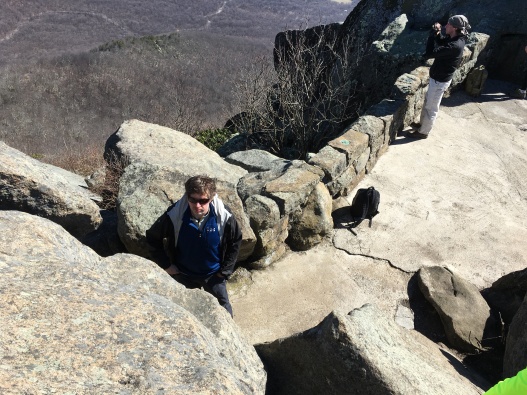
On the opening weekend of March, Sylvia and I were presented such an opportunity, and we did not miss it. While the rest of the Northeast was digging out from the howling winds of a Bomb Cyclone, we braved freezing winds to summit Sharp Top, and the result was an excellent hiking experience. Clear skies and a summit almost devoid of people…we could not have picked a better day.
We started the day with a three-hour drive north out of Raleigh, pausing for a stop in Bedford before continuing on to the very visible peaks looming in the distance. It had been windy in the Triangle area; arriving in the early morning at the parking area where route 43 intersects the BRP, it was as if we’d suddenly been transported to Patagonia. A ferocious wind whipped across the lot, sucking the heat from our bodies just seconds after leaving the shelter of the car. This rammed home the fact that my preparation for this hike had been somewhat on the shoddy side. Believing it to be an ‘easy’ walk I had left my wool hat and gloves at home. Only as an afterthought had I brought my full backpack, and only on Sylvia’s suggestion my puffy Kuhl jacket. Sylvia did have her wool hat…but had similarly forgot her gloves.
On another day, this might certainly have been an easy hike requiring minimal preparation. Not today. Though it was a short hike (three miles round trip), we would be going to an open, exposed summit in potentially hypothermic conditions, and were not fully equipped. I had failed, as even veteran hikers will do, to follow my own advice. I had not prepared for the conditions I was likely to face. A rookie mistake…underestimating the hike.
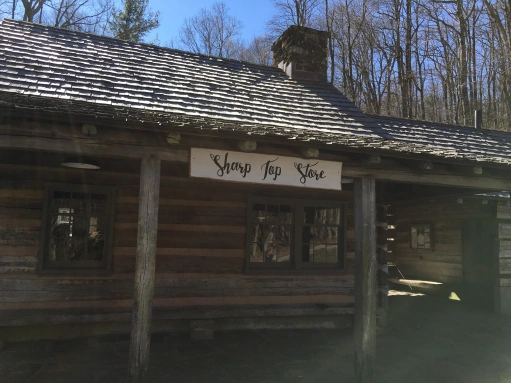
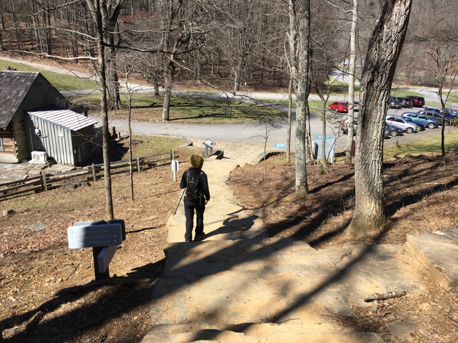
But we decided that we were nonetheless prepared enough to make the attempt. So we layered up and headed out on the trail behind the Sharp Top Store. A few other groups, mostly young college kids, were headed up but most were either well ahead of behind us. We were alone on the trail most of the time.
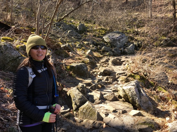
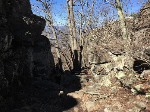
The Sharp Top Trail begins a steady ascent almost from the get go….first on a dirt trail with occasional rock steps, and then neared the top almost entirely on rock steps. It crosses the bus road (they weren’t running this day) and begins switch backing. We saw some patches of ice here and there, but nothing that couldn’t be avoided.
Very quickly the trail reaches a ridge line just below the craggy summit and makes its way along the western side of it, turning back eventually to proceed along the east facing back slopes of the same ridge just above. This day, the west facing slopes of the ridge were exposed to the wind, while the east, in the lee of the summit, were dead calm.
While on lower part of the ridge line, a group of hikers went by on the downswing, asking me as they passed if they knew the location of the ‘plane crash’ on the mountain. I replied that I had heard of it but did not know the exact location. They were referring to a B-25 Mitchell Bomber that crashed on the mountain many, many years ago…the location is deliberately not well publicized out of respect for crew members who lost their lives, but it can be reached by bushwhacking up the mountain (there is no official trail.) Those wishing to go there may easily obtain the GPS coordinates from the internet…but I do ask that you be respectful of the place. We did not go there.
Here’s a link to a good description of the crash site.
Once atop the summit ridge, the main trail breaks left at a signed intersection, while a side trail heads off to Buzzards Roost, another view point on the mountain. Though less than a quarter mile out of the way, round trip, my guess is the Roost doesn’t get much visitation for the simple reason that most head directly to the peak, and after visiting that have little interest in another, lesser viewpoint. So it might be a lot less crowded than the true summit (any local hikers know if this is true? Leave a comment.) On this day we slaked our thirst for views and did not summit; my own advice is to save it for the downhill and do it if you are still hungry for more views. It may be a viable and less crowded alternative during peak season.
Once upon the backside of the ridge, we were protected from the wind and actually became rather warm. Had we further to go I’d have delayered here, but I decided to keep my shell layer on, figuring we’d be breaking back into the full force of the wind shortly. I was right.
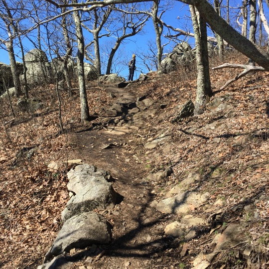
There are a lot of rock steps in this upper section, but the trailkwork is very good. There are also the remains of an old paved walkway with handrails here. The NPS is thankfully no longer maintaining these unnecessary herd paths for tennis-shoed tourists and the mountain is taking them back with a vengeance.
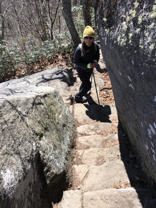
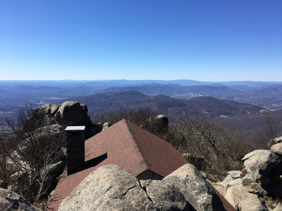
After going up a narrow slot in the rock over stairs, the trail goes through a cleft and then reaches another intersection just 300 yards from the summit. Here the trail to the bus station comes in from the right. It’s just a few more rock hops to the summit itself; the first view is of an old and now abandoned stone cabin just below the top. The trails breaks left of this building and up steps to some well-built stone structures that resemble battlements, finally arriving at the true summit which is perched just over the cabin roof.
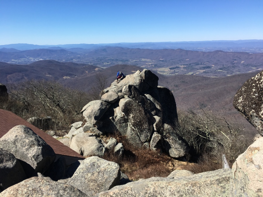
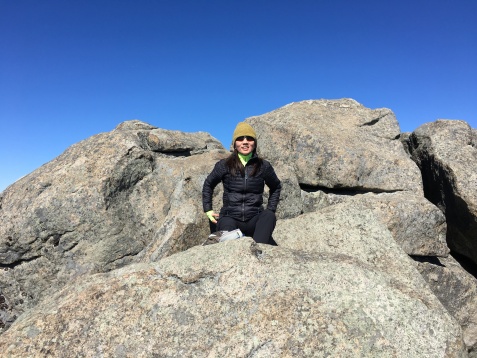
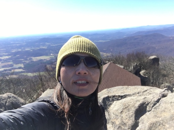
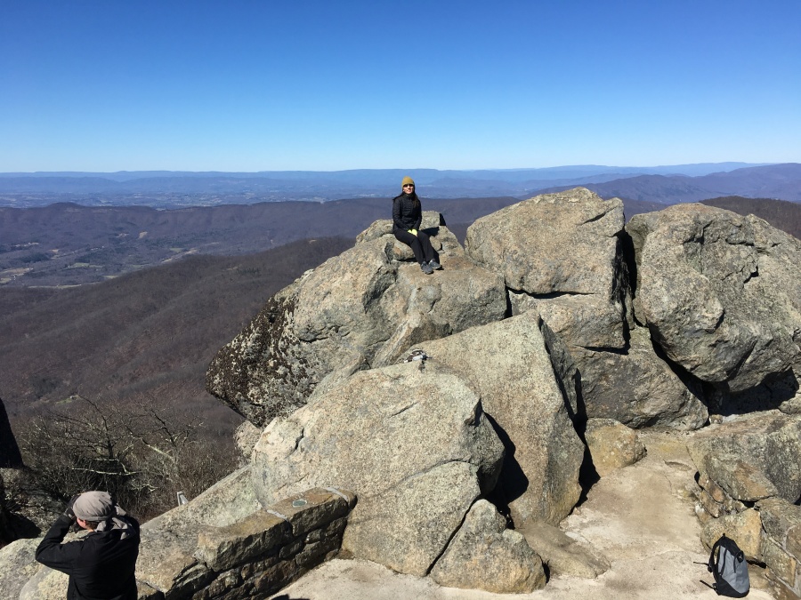
The climb behind us, we stepped out onto the wind-swept summit of Sharp Top. It is a VERY impressive place, one of the best views I have seen in the South, rivaling or perhaps even surpassing Mount Cammerer and Mt. Leconte (though the views are less of wilderness and more of bucolic pastures.) There are also several crags that more resemble tall spires made of stacked boulders.
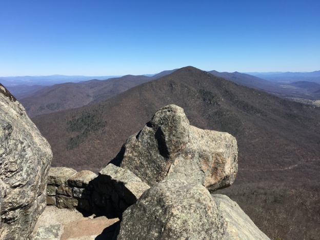
The actual summit is a flat lump of rock like a stone sofa atop the last short flight of steps. However, our opinion is the best views are from the boulder pile just to the right of the broad platform immediately below the true summit. You need to scramble up this ledge without the assistance of steps, but the reward here is an awesome view. Unlike the view from the true summit, which looks out over a seeming infinity of flatland stretching to the distant unseen ocean, the boulder pile affords unobstructed views up, down and across the Blue Ridge itself…more impressive for my money.
To the north is Sharp Top’s big sister, Flat Top. It doesn’t look very flat, really…but it’s less Sharp than Sharp Top. Beyond is Thunder Ridge and beyond that, far in the distance, Shenandoah National Park.
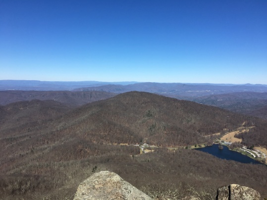
To the west is the Shenandoah and main Appalachian Valleys, with the Alleghany mountains and the wall of the Tinker Cliffs beyond. The Appalachian Trail, on its long journey to Katahdin, makes its way across this section of lowland to intersect the Blue Ridge.
Southward lie the big peaks of Southwestern Virginia, Tennessee and North Carolina. I thought I could make out the distant but distinctive massif of Grandfather Mountains, and without doubt the odd slouching peak known as Buffalo mountain, a notable landmark of that region. I looked for but could not find Pilot Mountain, which we had hiked the week before. But after a second review of the days photographs, I think I might have located it.
Beyond this, somewhere, too far for our eyes to see, are the Black Mountains, the Smokies, and somewhere beyond that Springer Mountain and the distant roots of the Appalachians.
One notable thing to mention here…On past trips to the summits of the Southern Appalachians I have often remarked on the disappointing effects of air pollution from coal fed power plants and industry in the Midwest, and how all the smog really detracts from the views. Well, on this day the high winds had carried the smog away and the result was staggeringly different.
This is what the southern Appalachians once were, and someday still could be…limitless views of pristine mountains under pure cobalt skies. Only a few distant clouds hovering far to the north, maybe as far away as Maryland, could offer any obstruction to this vista. It was a feeling of liberation, of being in a realm free of restrictions and boundaries. Far from detracting from this hike, the cold wind had made it what it was…a day like few others. We had seized the opportunity nature had offered.
Few others had joined us. Though this summit is probably mobbed in peak season, we had it mostly to ourselves. There were a few other parties there, mostly hardy college kids, and they were very respectful of one another. My observation as always is that the true hikers, young and old, are always polite and respectful both of each other and the spirit of the place; it is the would-be shuttle hikers of the kind we had seen on Pilot Mountain who inevitably ruin things for everyone. This day, there was no bus to catch and only a bitter wind to battle. The result was perfection.
After braving the wind for as long as we could we said goodbye to this magnificent summit. We paused for a snack beside the cabin, using it as a windbreak, then proceeded downhill, leaving the Buzzards Roost for another day. We passed a few intrepid groups, including one very large one, on the way up. They wouldn’t find the summit quite so uncrowded. As usual, an early start had helped us beat the herd.
As we descended the warming of the day had turned the frozen ground to muck, making the lower approaches as bit sloppy. But we made it back to the car without incident…about two and a half hours all-told to do the hike, including a half hour on the summit.
After we headed to Bedford for a well-earned burger and then went North on the BRP for some ‘auto-touring’ before turning south for the (as always) white knuckle evening drive through the mountains and back home. The parkway this time of year is mostly empty and littered with uncleared winter debris.
Sylvia and I both every much enjoyed the Sharp Top Hike, though the rare day we were given definitely enhanced the experience. We think it’s one of the best hikes in Virginia. We strongly advise you go off season, mid-week if possible. Avoid busy weekends in summer, when the peak will doubtless be overrun, and haze will obscure the views. Though quite steep, the trail is not very long and the footing is generally very good, so the trail could probably even be done in snow or ice as long as one had the proper gear and exercised caution. I would NOT recommend venturing out on the rock slabs of the summit in slippery conditions.
There is no doubt we will also do Flat Top in the future. There is more to explore here.
![IMG_0004[1545]](https://becauseitzthere.files.wordpress.com/2018/03/img_00041545.jpg?resize=463%2C347)
To sum up…take the trail, not the bus. Pick your spot carefully, enjoy the summit as it was meant to be enjoyed, and with luck, you will get a day as fine as the one we had at the Peaks of Otter.